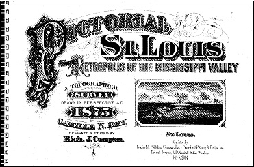
Pictorial St. Louis: Atlas of 1875 St. Louis
This is considered one of the best reference books for getting a feel for what St. Louis looked like in the late nineteenth century. Created by a meticulous artist, the maps take you street by street, house by house through the City of St. Louis in 1875. In addition to the beautifully drawn maps, there are pages of description of the history of the city and its businesses. The maps are drawn as if from above, giving perspective and allowing you to see the neighborhoods in great detail. A contents page in the front points to text on some of the most well-known places and businesses of the time. There is another page in the front that helps locate specific plates. The text is filled with facts and figures, including many statistics (population, commerce, and much more). There is narrative material on large businesses, such as title companies, schools, street railways, insurance companies, and banks, and hundreds of smaller businesses. All the business narratives contain names of individuals active in the firms. There is an extensive index in the back of the book. This is a book you will certainly want in your library if your ancestors were in the City of St. Louis in 1875.
Drawn by Camille N. Dry, reprinted by ImagineInk Pub. Co., Wentzville, Missouri, 2004, 223 pgs., hardcover
$100.00
30 in stock
Related products
-
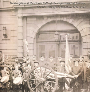
Indiana Civil War Veterans : Transcription of the Death Rolls of the Department of Indiana, Grand Army of the Republic, 1882-1948
$5.00 -

QuickSheet, Citing Online African-American Historical Resources
$7.00 -

The Best of Our Blog, The First Ten Years: 2012-2021, Parts One & Two
$6.00 -

War of 1812 in Missouri, Set of Volumes 1 and 2
$40.00